_1781464136662-DVw5IPjt.png)
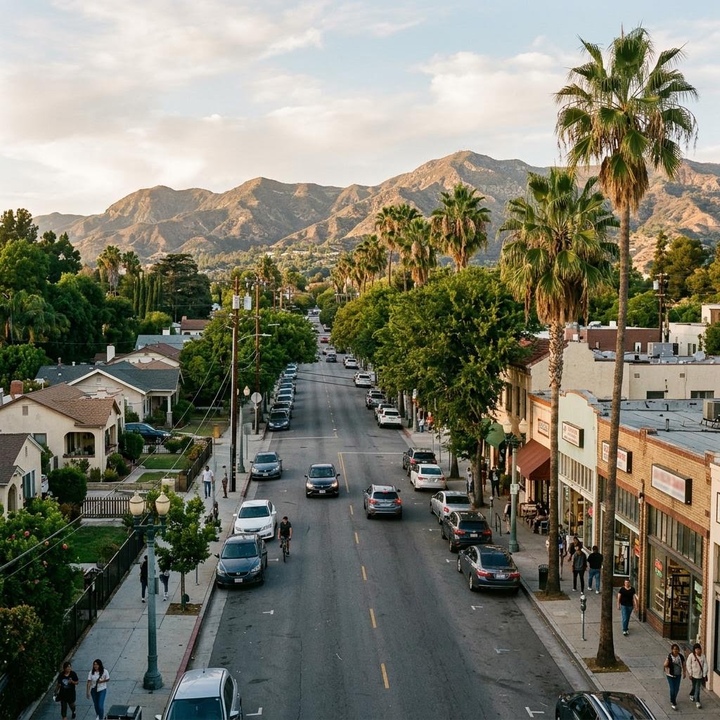
Atwater Village
Permit Expediting
A City of Los Angeles neighborhood between the river and Glendale, permitted by LADBS, with a mapped pedestrian district along its two main boulevards.
Women-owned, Los Angeles-based permit expediting firm. We bring the same LADBS coordination we use in Silver Lake and Los Feliz to Atwater Village remodels, ADUs and boulevard tenant improvements. Free initial consultation: call 213-277-8777.
Atwater Village sits between the Los Angeles River and the City of Glendale. It is part of the City of Los Angeles, so permits go through LADBS, but the neighboring city line, a mapped pedestrian district and parcel-specific river overlays mean the first permitting question is always the same: what applies to this exact parcel?
The neighborhood's housing stock is dominated by 1920s and 1930s Spanish revival and Tudor-style bungalows on modest lots, with small multifamily buildings mixed in. Most residential projects are kitchen and bath remodels, seismic and electrical upgrades, garage conversions and new detached ADUs. The commercial life of the neighborhood runs along Glendale Boulevard and Los Feliz Boulevard, where cafes, small retailers, studios and service businesses regularly turn over storefronts and need tenant improvement permits.
Several projects in Atwater raise questions that do not come up in every Los Angeles neighborhood. A storefront on Glendale Boulevard may be inside the Atwater Pedestrian Oriented District, which adds frontage, access and sign standards. A home near the river may or may not be inside the River Improvement Overlay. A property near the Glendale line needs confirmation of which city actually issues the permit. None of these should be assumed from the street address alone.
For neighboring context, see our Eagle Rock, Silver Lake and Los Feliz guides. Glassell Park, across the river, follows the same LADBS framework and is scoped the same way.
LADBS, Not Glendale: Confirming Jurisdiction
Atwater Village is inside the City of Los Angeles, and LADBS reviews building, electrical, plumbing and mechanical permits under the Los Angeles Municipal Code. Glendale has its own building department, fee schedule and submittal system. The boundary between them does not follow mailing addresses or ZIP codes neatly, so a property with a familiar Los Angeles address is not automatically inside the City, and the reverse is also true. We confirm jurisdiction by the Assessor Parcel Number and the City's official mapping before preparing any application.
City of Los Angeles: LADBS jurisdiction
Parcels inside City limits are permitted by LADBS under the Los Angeles Municipal Code. Glendale, to the north, is an independent city. Jurisdiction is confirmed by APN and the official boundary, not the postal address.
Atwater Pedestrian Oriented District (Ordinance 173676)
A supplemental use district under LAMC 13.07 covering mapped portions of Glendale and Los Feliz Boulevards. It adds frontage, pedestrian access and sign standards and use checks for qualifying exterior changes. It is not neighborhoodwide.
Los Angeles River Improvement Overlay
Parcel-mapped only. Verify inclusion in ZIMAS before assuming RIO standards apply to a river-adjacent project.
Base zoning and mapped hazards
Zoning, flood, soil, or other reported hazards near the river vary parcel by parcel and require confirmation, not assumption.
Building and trade codes
LADBS applies the California Building, Residential, Electrical, Plumbing, Mechanical and Energy codes with Los Angeles amendments for the applicable code cycle.
The Atwater Pedestrian Oriented District
The Atwater Pedestrian Oriented District was established by Ordinance 173676, adopted in 2000, as a supplemental use district under LAMC Section 13.07. It applies to mapped portions of Glendale Boulevard and Los Feliz Boulevard. It does not cover the residential blocks of the neighborhood and does not apply to every commercial parcel; inclusion is shown in the parcel's zoning record.
For parcels inside the district, the ordinance adds standards intended to keep the boulevards walkable: how buildings address the sidewalk, where pedestrian entrances are located, how frontage is treated and what signs are permitted. Qualifying exterior changes, new construction, new signage and certain changes of use can trigger a review against these standards in addition to the normal LADBS plan check. We read the ordinance against the specific scope rather than summarizing restrictions that may not apply to your use.
In practice this means a cafe moving into an existing storefront with no exterior change is a different conversation from a new facade with new glazing and a projecting sign. Our tenant improvement service starts with that distinction so the lease timeline reflects the actual review.
River Overlay, Flood and Soil Questions
The Los Angeles River Improvement Overlay applies only to mapped parcels. Some Atwater properties near the river are included and many are not. Where a parcel is mapped, design and landscape standards may apply to certain projects. Where it is not, they do not, regardless of how close the river feels. We verify the overlay in ZIMAS for every river-adjacent project.
The same caution applies to flood zones, liquefaction or soil conditions and other reported hazards. These are parcel determinations based on mapping and reports, not neighborhood generalizations. If a parcel is mapped, the design team decides what geotechnical or flood documentation is needed, and we track the related plan check comments.
Bungalow Remodels, ADUs and Routine Upgrades
Older bungalows often reveal undersized electrical service, cast iron or galvanized plumbing, and unpermitted earlier work when walls are opened. We review the permit history first so the scope addresses legalization where needed. Garage conversions and detached ADUs follow the ADU permit path, subject to the lot's actual layout and utilities.
Routine work still needs permits. See our guides to reroofing permits and sewer lateral permits for two common Atwater projects.
Atwater Village Project Types and Review Paths
| Project Type | When It Applies | Typical Review Path | Parcel Check |
|---|---|---|---|
| Single-family remodel | Kitchen, bath, structural or system upgrades in an older bungalow | LADBS plan check or Express where eligible; trade permits | Existing permit records and unpermitted prior work |
| ADU or JADU | Garage conversion or new detached unit | LADBS ministerial ADU review | Lot layout, utilities, any mapped overlay or hazard |
| Corridor tenant improvement | Retail, cafe or office build-out on Glendale or Los Feliz Boulevard | LADBS TI plan check; Planning check if in the POD | POD mapping, signs, frontage, change of use |
| Storefront or sign change | New facade, glazing, or signage | LADBS sign or building permit | POD sign and frontage standards on mapped parcels |
| River-adjacent project | Parcel near the Los Angeles River | LADBS plus parcel-specific overlay review | RIO mapping, flood or soil reports if identified |
| Reroof or sewer lateral | Roof replacement or lateral repair | LADBS building or plumbing permit; Public Works where in right-of-way | Scope and right-of-way location |
Timeline Allowances and Fee Basis
These are nonbinding planning allowances assuming complete, coordinated plans. They exclude design, construction, entitlements and utility work, and can run longer. Fees are calculated by LADBS using current schedules; use the LADBS permit fee calculator for estimates.
| Project | Planning Allowance | Fee Basis |
|---|---|---|
| Straightforward remodel | 4 to 8+ weeks | Valuation-based building permit, plan check, trade permits |
| ADU or JADU | 8 to 16+ weeks | Valuation, plan check, trade permits; impact or utility charges where applicable |
| Room addition | 12 to 24+ weeks | Valuation, plan check, trade permits; school or other fees where triggered |
| Corridor tenant improvement | 8 to 16+ weeks | Valuation, plan check, trade permits; Planning fees if POD review applies |
| Express-eligible minor work | Days to a few weeks | Scheduled fees for eligible scope only |
Express permits apply only to eligible minor scope. No fixed agency fees are implied.
Our Process for an Atwater Village Project
- 01
Confirm jurisdiction by APN
We confirm the parcel is inside the City of Los Angeles and not Glendale using the APN and official boundary.
- 02
Pull ZIMAS and permit records
We check zoning, the Pedestrian Oriented District, RIO mapping, any mapped hazards and existing permits.
- 03
Scope against overlays
We compare frontage, sign, access and use questions with the ordinance where the parcel is mapped.
- 04
Complete the submittal
We coordinate architecture, structural, MEP and energy documents so the application is not returned as incomplete.
- 05
Manage plan check and corrections
One correction log, assigned to each consultant, with a consistent resubmittal.
- 06
Issuance, trades and utilities
Trade permits are issued and utility or right-of-way items are tracked separately.
- 07
Inspections and final
We sequence inspections through final sign-off or certificate of occupancy.
Frequently Asked Questions
Is Atwater Village permitted by LADBS or by Glendale?
Atwater Village is a City of Los Angeles neighborhood, so building permits for parcels inside the City go through LADBS. Glendale is an independent city with its own building department directly to the north. Because the boundary does not follow postal addresses, we confirm jurisdiction by APN and the official City boundary rather than the mailing address.
What is the Atwater Pedestrian Oriented District?
It is a supplemental use district established by Ordinance 173676, adopted in 2000, under LAMC Section 13.07. It applies to mapped portions of Glendale Boulevard and Los Feliz Boulevard, not to the whole neighborhood, and adds standards for building frontage, pedestrian access and signs, along with use checks for qualifying projects.
Does the Pedestrian Oriented District affect my storefront remodel?
It can, if the parcel is inside the mapped district and the work involves qualifying exterior changes, new signs or a change of use. Interior-only work in a mapped parcel may raise fewer questions. We confirm the mapping in ZIMAS and compare the scope with the ordinance before design is finalized.
Is every Atwater Village property in the Los Angeles River Improvement Overlay?
No. The River Improvement Overlay is parcel-mapped. Some Atwater parcels near the river may be included and others are not. We verify the parcel's ZIMAS record instead of assuming a blanket overlay.
Can I build an ADU in Atwater Village?
Many residential lots can support an ADU or JADU under state law and the City's ordinance, but lot configuration, existing structures, utilities, hillside or other mapped conditions and any overlay must be confirmed for the specific parcel.
Do flood or soil conditions near the river apply to my lot?
Only where the parcel is actually mapped or a report identifies them. Proximity to the river does not establish a hazard on its own. We review ZIMAS and any available reports, and the design team decides whether geotechnical or flood-related documentation is needed.
How long does an Atwater Village permit take?
Our planning allowances range from roughly 4 to 8+ weeks for a straightforward remodel to 12 to 24+ weeks for an addition, assuming complete coordinated plans. These are nonbinding estimates, not agency deadlines.
How are LADBS fees calculated for my project?
LADBS fees are based on valuation, plan check, trade permits and any applicable surcharges, using current schedules. The LADBS permit fee calculator gives scope-specific estimates; we do not quote fixed agency fees in advance.
Why work with Ocean Permits in Atwater Village?
Ocean Permits & Development is a women-owned Los Angeles permit expediting firm that confirms jurisdiction, overlays and scope before submittal, then manages plan check and inspections. Call 213-277-8777 for a free initial consultation.
Official references
Reviewed October 12, 2026. Confirm current requirements for your parcel.
Atwater Pedestrian Oriented District, Ordinance 173676
Building in Atwater Village?
We confirm jurisdiction and overlays, then coordinate LADBS plan check through final.
Nearby Locations